
Walking in the dry river of the Rio Seco, Pinar de Campoverde
What is Rio Seco?
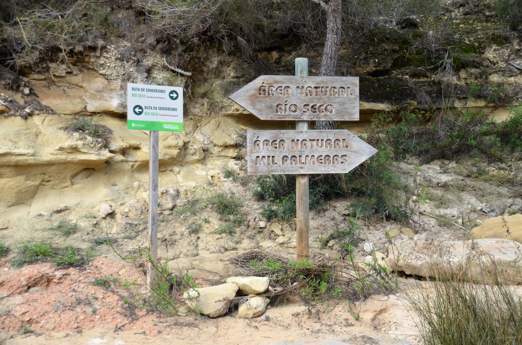
The 19 kilometres-long Rio Seco (dry stream/river) is a hydrological catchment area, which flows/runs from the mountains of the Sierra Escalona through the municipal district and empties into the Mediterranean Sea at Mil Palmeras. The Natural Reserve is accessible by a forestry path, which is situated next to the sports grounds of the urbanization Pinar de Campoverde, near the town of Pilar de la Horadada.
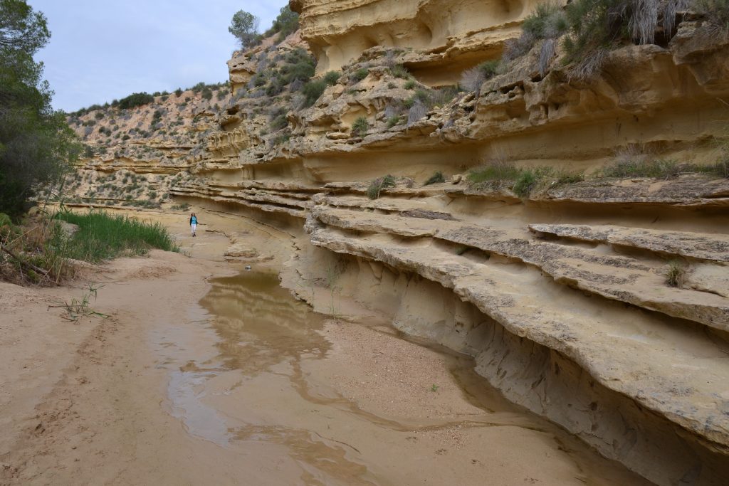
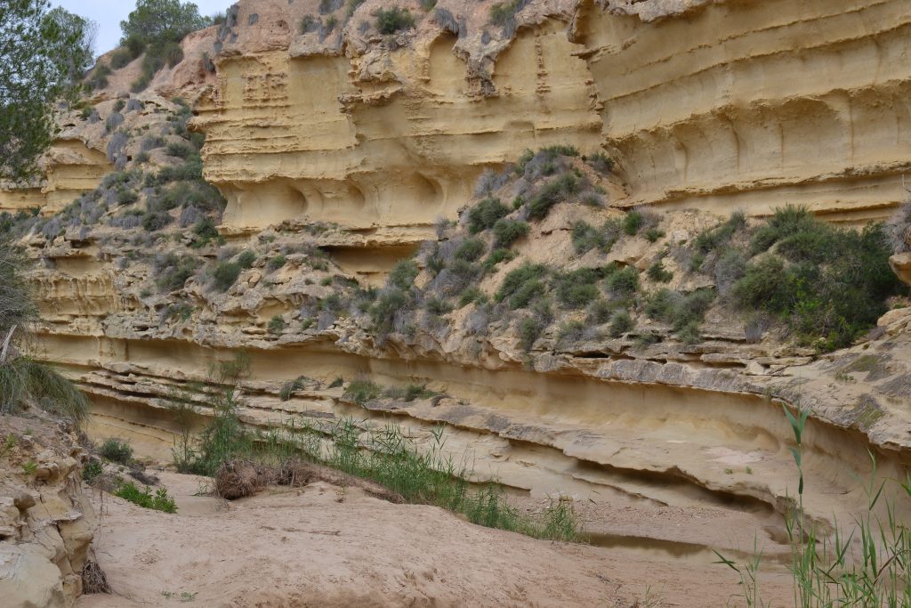
On account of the low precipitations in this climatic zone, Rio Seco is considered more like a dry riverbed than a river. From the agrarian farms in the surroundings the water seeps continuously into the Rio Seco, which maintain its great natural diversity. In the surroundings of this Natural Reserve we find innumerable Mediterranean species and flora and fauna. Due to its closeness to lower ground, the presence of birds of prey is notable.
Route 1: 3,5 km long
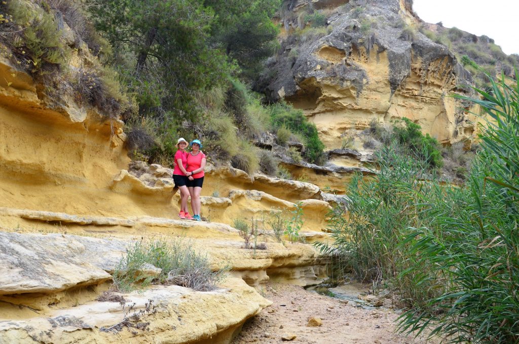
In the nature reserve of the Rio Seco you will see many beautiful places. The walk normally starts at the parking near the visitor center, but you can also start at another location.If you leave at the visitor center you walk a little back on the road until you reach a narrow path on the left. This path leads to a large open space. There you turn right downwards at the route sign. You walk through the forest for a while and then descend to the bed of the Rio Seco.
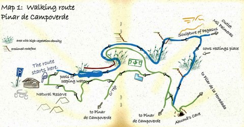
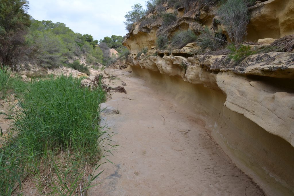
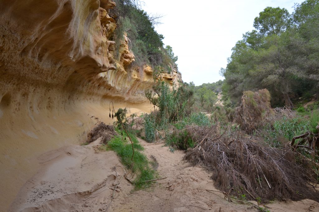
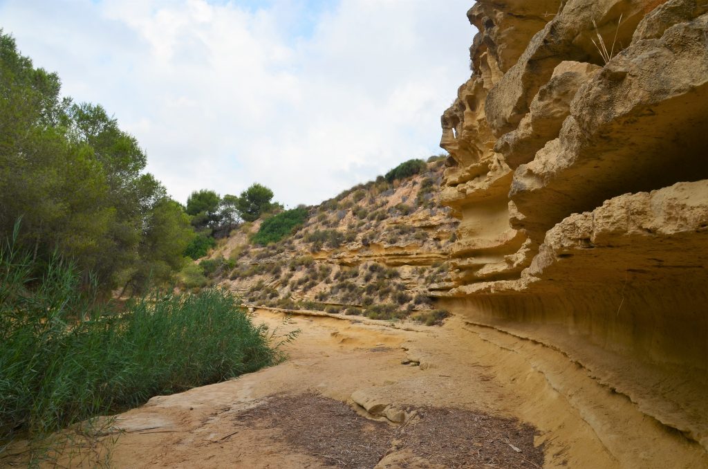
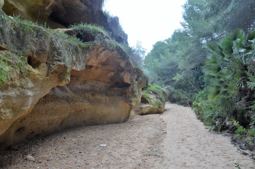
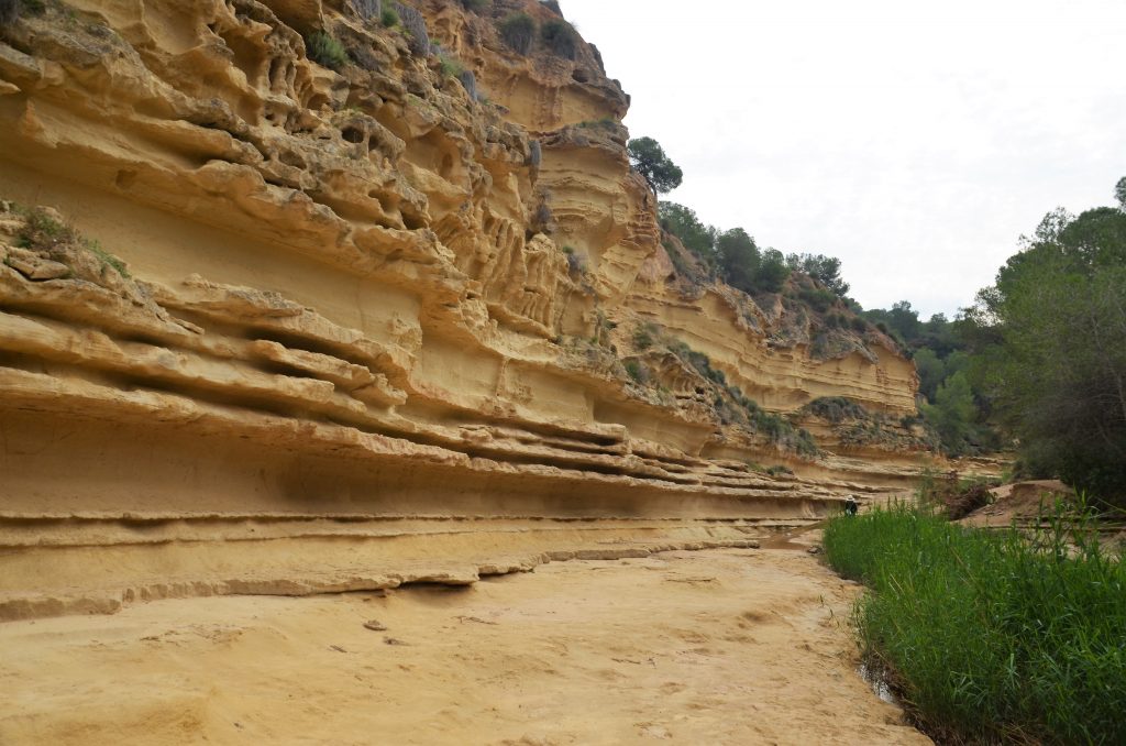
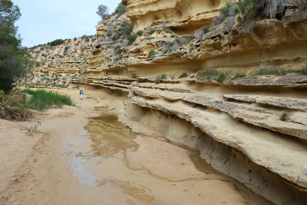
As you walk through the river bed you will see beautiful sandstone rocks formed by erosion. Sometimes you may have to step through some mud to cross the river. A little further there is a junction where you turn right into the bed of a small affluent. Here you will end up in a much greener area. This path ends at an asphalt road where you turn right. Barely a few meters past the place where the path ends, you see a small cave on the other side of the road. This brings you to the end of the walk. You follow the road for a short while past a restaurant and sports grounds and you will be right back at the parking lot and the visitor center.
Route 2: 10 km long
Unlike the short walk, this walk does not consist of a loop. It is therefore best to meet up with several people so that you prepare a car at the end point, unless you choose to cover the same distance upstream after 10 kilometers downstream.
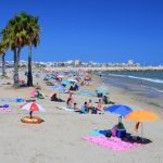
This walk also starts at the visitor center. There is a split just past the place where a horse is engraved in the rocks. For the short walk we went right there, this time we go left. From there you can walk some 8 kilometers in and next to the Rio Seco. You pass the vast fields of a mandarin grower and you can go through a tunnel under a road just like the water does (you can cross the road if there is too much water). We find the terminus of the river on the beach where a narrow channel flows into the sea.
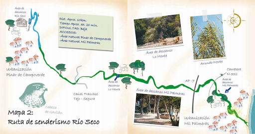
This walk is approximately 10 kilometers long and you must count 3 to 3,5 hours of walking time. Along the way you will not find any restaurants and in many places you are little protected against the sun by plants. So take plenty of water with you and do not do this walk at the hottest moment of a summer day. The end point is near a large parking lot.
 Previous post
 Next post